Over the course of the weekend, California incurred a number of wildfires. Some were attributed to natural causes, however, the Mill Fire and Fairview Fire appear to have been caused by human activity, and we are actively investigating both fires for recovery potential. We have dispatched our investigators to the scenes and have been gathering social media images, witness information, public disclosures, and other relevant data on the fires. As there may be subrogation potential in these two fires, we are providing you with this early Alert so that you can search for claims.
Mill Fire
The Mill Fire started just before 12:49 p.m. on September 2, 2022, in the town of Weed, California. It remains an active fire, having destroyed more than 4,000 acres to date, and is currently 55% contained. The number of structures destroyed is still being evaluated, but some estimates have over 100 structures destroyed as the fire decimated the Lincoln Heights neighborhood in the town of Weed.
Our retained experts have been investigating this fire since the onset. Early images of the fire have helped to narrow down the origin area to in or adjacent to a lumber warehouse owned by Roseburg Forest Products. Roseburg, a major wood products company, stored spare equipment for its nearby veneer mill in the warehouse. A representative for Roseburg initially stated that it was not performing any work in or around its warehouse at the time of the fire, and the warehouse is simply used for storing spare parts. However, yesterday Roseburg acknowledged that its mill produces its own electricity in a co-generation facility fueled by wood remnants and that a water spraying machine used to cool the ash may have failed, potentially resulting in the fire. This would be consistent with observations of early firefighters who reported seeing black smoke at the Roseburg mill/warehouse, consistent with the early images of the fire.
We received some intel that utility company Pacific Power was performing work near the warehouse on a power pole and that there was a power outage before the fire. We’re investigating all of these leads. Of note, Pacific Power has not filed an incident report with the California Public Utilities Commission (CPUC). Such reports are required whenever a utility’s equipment could be involved with the ignition of a wildfire that causes damage or loss of life (although the lack of an incident report is certainly not determinative of the cause of the fire).
If you have claims from the Mill Fire, please let us know as soon as possible, and we will provide further updates as our investigation develops. Zip codes impacted by the Mill Fire include 96094 (primary structure loss) as well as smoke damage to surrounding zip codes 96067 and 96064. The start date was September 2, 2022.
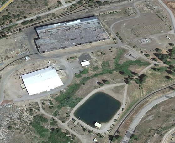
Google Earth Image of Warehouse of Interest
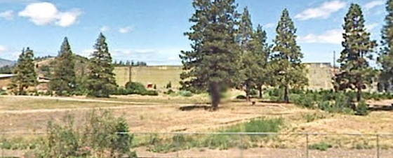
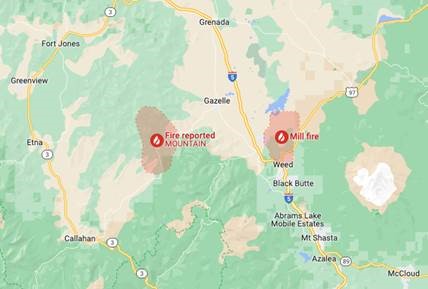
Map of Mill Fire Location and Neighboring Mountain Fire
Fairview Fire
The Fairview Fire started at approximately 3:37 p.m. on September 5, 2022, in Hemet, California. It remains an active fire, having destroyed more than 2,400 acres and seven structures to date, and is currently 5% contained. It has tragically caused two fatalities.
Utility company Southern California Edison (SCE) has filed a required CPUC incident report. The report simply states that it is being filed out of an abundance of caution, noting that “circuit activity occurred close in time to the report time of the fire.” The involved circuit is the Sprague 12kV distribution circuit. We are working to gather more information on this circuit that is always critical to our inverse condemnation cause of action.
If you have claims from the Fairview Fire, please let us know as soon as possible, and we will provide further updates as our investigation develops. Zip codes impacted by the Fairview Fire include 92544 (primary structure loss) as well as smoke damage to surrounding zip codes 92539, 92536, 92592, 92543, 92581, and 92583. The start date was September 5, 2022.
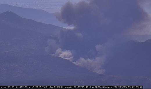
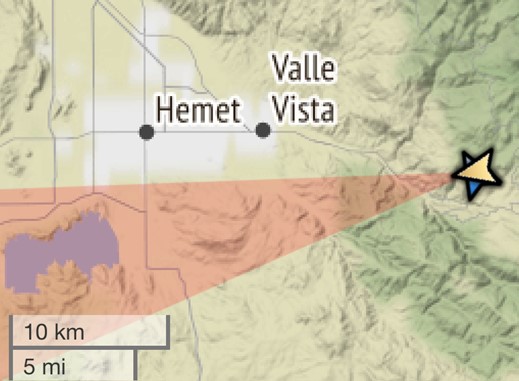
Below is an early image from a wildfire alert camera, one of many helpful tools we utilize in narrowing down the general origin area of a wildfire. The wildfire alert system is a series of cameras throughout the Western United States, developed in conjunction with the University of California San Diego and the University of Reno. Below is an early photo as well as the direction the camera was facing for illustration. Our experts utilize these images, as well as social media images, property surveillance photos, witness statements, and scene burn patterns, to help establish an overall origin area.
We also continue to monitor the other significant California fires that ignited last week, including the Mountain Fire (just 12 miles to the west of the Mill Fire), Route Fire (Los Angeles County), and the Border fire (east of San Diego). We will send a further update if we determine that these fires may have subrogation potential.
